Description
Recon offers drone LiDAR services to enable the surveying of complex and vegetated sites. LiDAR, or light detection and ranging, sends millions of pulses of light which reflect off the ground, trees and other features enabling the modelling and analysis of complex environments.THE BENEFITS OF LIDAR
- LiDAR technology opens up a number of difficult environments to the powerful benefits of 3D surveying.
- In areas where a field survey is impractical or unsafe, and dense vegetation or other ground cover prevents the use of photogrammetry, a LiDAR drone survey is able to capture the survey data that no other technology can.LiDAR works by sending out lasers which are then reflected back and capture distances from objects on the ground.
- During a drone flight, a LiDAR scanner is able to capture millions of 3D coordinates per second.
- The amount of data points that LiDAR collects is what gives the technology its unique surveying capability.
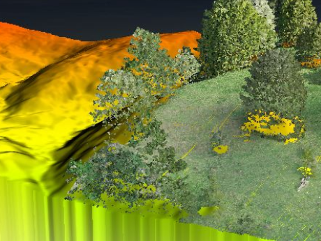
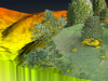
- Even in dense vegetation, LiDAR surveying is able to collect enough points from the ground to accurately survey the underlying terrain. This ability to distinguish between ground cover and underlying terrain also allows LiDAR to survey small but important man-made objects in 3D, such as power lines.
- While standard drone survey methods can’t survey objects that are small and visually difficult to distinguish, LiDAR technology is able to do so with ease.